
高中一年级 · 阅读系列
Lesson 24 · The River in a Satellite Image
文体:地理课记录 · 朗读音轨 24
先听一遍
听听两张卫星照片为何不足以证明河道已经改变。
展开英文短文,再悬停查词
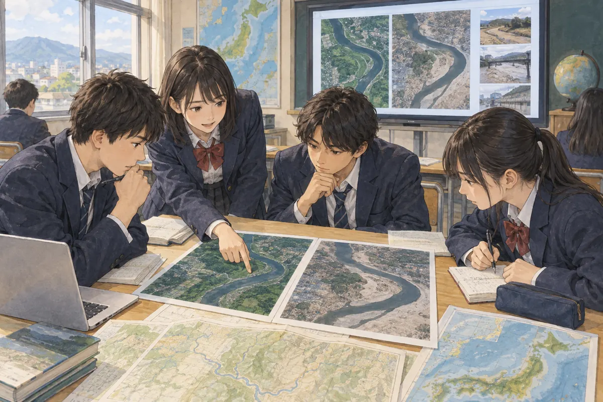
In geography class, we compared two satellite images of a river. One had been taken ten years earlier. In the newer image, a pale curve appeared beside the water. My first thought was that the river had moved.
Our teacher asked us to check the dates and seasons. The older picture was from a dry month; the newer one followed heavy rain. A wider river after rain might look like a new course, even if the land had not changed much. We searched for more images taken in similar seasons and looked for reports from people living nearby.
The extra evidence suggested that part of the riverbank had changed slowly, while the water level also varied from season to season. Both processes mattered. We could not explain the whole place from two pictures alone.
The satellite view made a large pattern visible. The dates, weather, and local reports helped us understand what that pattern might mean.
逐句跟读
点击任意一句听 Dicvo 的 Jenny 英语语音;开始连续播放前可选择每句播放次数。同一句的每遍之间、切换到下一句之前,都会留出约一遍句子时长供你跟读。原有整篇朗读仍可在上方播放。
请选择一句开始。
-
In geography class, we compared two satellite images of a river.
-
One had been taken ten years earlier.
-
In the newer image, a pale curve appeared beside the water.
-
My first thought was that the river had moved.
-
Our teacher asked us to check the dates and seasons.
-
The older picture was from a dry month; the newer one followed heavy rain.
-
A wider river after rain might look like a new course, even if the land had not changed much.
-
We searched for more images taken in similar seasons and looked for reports from people living nearby.
-
The extra evidence suggested that part of the riverbank had changed slowly, while the water level also varied from season to season.
-
Both processes mattered.
-
We could not explain the whole place from two pictures alone.
-
The satellite view made a large pattern visible.
-
The dates, weather, and local reports helped us understand what that pattern might mean.
读懂了什么?
读完后,试着用一句话说出本文的主要意思,并从原文找出支持它的一句话。
查看中文译文
地理课上,我们比较了两张河流的卫星照片。其中一张拍于十年前。在较新的照片里,河水旁出现一道浅色的弯曲地带。我起初以为河道移动了。
老师请我们核对拍摄日期和季节。旧照片拍于干燥的月份;新照片则拍在大雨之后。雨后水面变宽,即使土地变化不大,也可能让人误以为河流改道。我们又查找相近季节拍摄的其他照片,并阅读附近居民的记录。
更多证据表明,部分河岸在缓慢变化,同时水位也随季节起伏。两种过程都不能忽略。仅凭两张照片,我们无法解释这个地方的全部变化。
卫星视角让大范围的形态变得可见。拍摄时间、天气和当地记录,则帮助我们理解这些形态可能意味着什么。
本课重点词语
以下是本课重点词语的中文讲解;英文正文中有虚线的单词可悬停查看词义和发音。
- satellite image
- 卫星照片;用于比较河流的影像。
- pale
- 浅色的;新照片中出现的弯曲地带。
- curve
- 弯曲线条;河边可见的形状。
- course
- 河道;主人公误以为它移动了。
- follow heavy rain
- 发生在大雨之后;新照片的拍摄时机。
- water level
- 水位;可随季节和降雨改变。
- vary
- 变化;水位有季节差异。
- process
- 过程;河岸变化和水位变化同时存在。
- local report
- 当地记录;来自附近居民的资料。
- pattern
- 形态、规律;卫星影像呈现的整体样子。
背景知识
比较不同时期的卫星影像,需考虑季节和降雨。河岸形状与水位都可能变化;增加相近季节的影像和当地资料,才能更稳妥地解释差异。