
High 1 · Reading series
Lesson 29 · A Map for the Next Heavy Rain
Audio track 29
Listen first
Listen once before opening the English passage.
Open the English passage and hover for word help
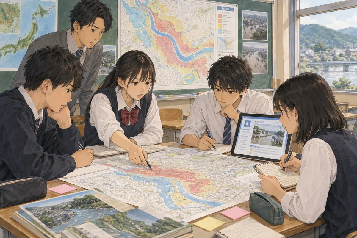
Our geography teacher asked us to read the town's official flood map. Colors showed areas that might be affected under certain conditions. I found our school and my home, then drew the route I usually took between them.
At first, I thought the colored areas gave me a complete answer. But the map was made for a particular purpose and scale. It did not show every step, gate, or temporary road closure. Our teacher reminded us that the town's current notices and instructions also mattered.
We practiced finding the date, legend, and source of the map. Then we listed questions to ask at a community meeting: Which routes are currently open? Where can people get updated information? We did not turn our classroom sketch into a personal safety plan for everyone.
The map helped me see a wider pattern. Learning its limits made me more careful, not less interested. Good information can be useful without answering every question by itself.
Sentence practice
Play any sentence in Dicvo’s Jenny English voice. Before playing all, choose how many times each sentence plays. A practice pause about as long as the sentence follows each play, including before the next sentence. The complete reading remains above.
Choose a sentence to begin.
-
Our geography teacher asked us to read the town's official flood map.
-
Colors showed areas that might be affected under certain conditions.
-
I found our school and my home, then drew the route I usually took between them.
-
At first, I thought the colored areas gave me a complete answer.
-
But the map was made for a particular purpose and scale.
-
It did not show every step, gate, or temporary road closure.
-
Our teacher reminded us that the town's current notices and instructions also mattered.
-
We practiced finding the date, legend, and source of the map.
-
Then we listed questions to ask at a community meeting: Which routes are currently open?
-
Where can people get updated information?
-
We did not turn our classroom sketch into a personal safety plan for everyone.
-
The map helped me see a wider pattern.
-
Learning its limits made me more careful, not less interested.
-
Good information can be useful without answering every question by itself.
Check your understanding
After reading, state the main idea in one sentence and find a line that supports it.
Chinese translation
地理老师让我们读镇上的官方洪水风险地图。地图用颜色标出在特定条件下可能受影响的区域。我找到学校和自己的家,又画出平常往返其间的路线。
起初,我以为着色区域已经给出了完整答案。可地图是按特定用途和比例尺绘制的,不会显示每一级台阶、每道门或临时封闭的道路。老师提醒我们,还要留意镇政府当下发布的通知和指示。
我们练习查找地图日期、图例和来源,然后列出想在居民会议上询问的问题:哪些路线目前开放?人们从哪里获取最新信息?我们没有把课堂上画的草图当作适合所有人的个人安全计划。
地图让我看见了更大范围的风险分布。了解它的局限,使我使用信息时更谨慎,而不是失去兴趣。好的资料可以很有用,却未必能单独回答所有问题。
Key words and expressions
Key terms have Chinese explanations. Hover over dotted words in the English passage for word help and pronunciation when available.
- official
- 官方的;来自镇政府的地图。
- flood map
- 洪水风险地图;显示可能受影响区域。
- be affected
- 受影响;颜色标示可能的风险。
- under certain conditions
- 在特定条件下;地图并非预告每次事件。
- scale
- 比例尺;限制能显示的细节。
- temporary
- 临时的;道路可能暂时封闭。
- current
- 当前的;还要查看最新通知。
- legend
- 图例;解释地图颜色和符号。
- source
- 来源;使用地图前要查明。
- limit
- 局限;一张图无法说明每个细节。
Background notes (Chinese)
官方风险地图提供区域性的参考,但有特定比例尺和制作条件。实际情况还需结合最新官方通知;课堂练习图不能代替个人应急安排。